The Evolution of Wrist-Based Navigation: How Offline Maps Moved from Luxury Fitness Wearables to Mid-Range and Budget Sports Watches

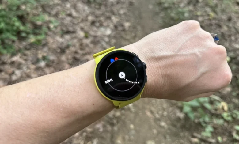
For years, integrated wrist maps stood as an unyielding luxury within the fitness technology market. Runners, hikers, and outdoor adventurers seeking the security of offline cartography directly on their wrists were forced to invest in flagship devices, routinely spending upwards of $800 to $1,000 on high-end sports watches. However, a significant shift in the fitness wearable sector has democratized this capability. Manufacturers have successfully trickled down advanced mapping infrastructure into mid-range and entry-level models, making offline navigation accessible to a much broader demographic of athletes without requiring a professional-tier budget.

To understand the weight of this technological migration, one must first examine what distinguishes true wrist mapping from the baseline location tools that have populated the market for over a decade. The industry generally categorizes outdoor wearable navigation into three distinct tiers: GPS tracking, breadcrumb navigation, and fully realized offline maps.
GPS, or Global Navigation Satellite System, tracking represents the foundational layer. Every modern running and hiking watch possesses the ability to communicate with orbital satellites to pinpoint a user’s coordinates on Earth. During a workout, this hardware logs speed, distance, and elevation. However, standalone GPS data traditionally relies on post-workout synchronization; the watch records raw coordinate points, which are later rendered onto a map interface on a smartphone or desktop computer via an active internet connection.

The intermediate step, breadcrumb navigation, provides real-time positioning on a blank or minimalist digital canvas. While exercising, the user views a digital line tracing the exact path they have traversed. Furthermore, pre-planned routes or courses can be uploaded to the device, generating a directional path overlaid against the user’s live track. While many devices featuring breadcrumb technology can deliver turn-by-turn directions based on these uploaded routes, the underlying system operates within a vacuum. It recognizes the path, but it remains blind to surrounding geography, such as intersecting trails, adjacent bodies of water, or nearby roads.
True offline maps represent the pinnacle of wrist-based cartography. Beyond tracking current coordinates and historical paths, a watch equipped with onboard offline maps visually renders the surrounding world. Users can see terrain features, street grids, topographical contours, and natural landmarks directly on their device screens. This spatial awareness drastically reduces the likelihood of navigational errors, allowing runners and hikers to instantly recognize when they are approaching an unintended intersection, a bridge, or a trail fork.

The integration of these comprehensive geographic information systems (GIS) onto smaller hardware introduces distinct engineering hurdles. Chief among these is internal storage capacity. Unlike smartphones, which leverage gigabytes of cloud-backed memory, sports watches operate within restricted physical boundaries. High-resolution topographical maps and regional street grids demand substantial data storage. Consequently, users frequently must selectively download specific geographic regions—such as a single state or metropolitan area—via a companion smartphone application while connected to a high-speed home network, rather than pulling map data dynamically over cellular networks while deep on a remote trail. Once installed, these cached maps remain operational indefinitely, providing robust offline utility in areas completely devoid of cellular service.
Historically, dominant market players like Garmin reserved full-color, routable maps strictly for their premier product categories, such as the Fenix and Epix lines. For consumers strictly interested in the Forerunner series, access to integrated cartography demanded purchasing the top-tier Forerunner 900-series devices, such as the 955, 965, or the newer 970 models, which command retail prices starting around $750. Devices residing in the lower numerical tiers—such as the Forerunner 165 or mid-tier fitness trackers—were systematically stripped of mapping capabilities, limited strictly to basic breadcrumb functionality.

This pricing paradigm faced disruption as rival manufacturers began leveraging software updates and aggressive component pricing to close the gap. Coros, a brand recognized for cultivating a loyal following among endurance athletes through lightweight hardware and extensive battery longevity, altered the competitive landscape by introducing offline mapping to its economical lineup via firmware enhancements. Notably, models like the Coros Pace series integrated functional offline mapping capabilities, elevating affordable daily training devices into capable backcountry tools, albeit constrained by internal memory limits that restrict regional downloads.
Concurrently, Suunto established a formidable presence in the mid-tier market by offering durable outdoor tracking hardware equipped with responsive map rendering and intuitive directional prompts. Devices positioned around the $399 to $499 price bracket bridged the gap between elite mountaineering gear and consumer-grade fitness trackers, providing robust outdoor performance without the four-figure price tag associated with traditional luxury sports watches.

At the aggressive entry level, brands operating under the Amazfit umbrella have redefined affordability within the sector. By packing bright, high-resolution displays and functional offline mapping software into devices retailing near the $170 mark, these manufacturers have lowered the financial barrier to entry. While independent product evaluations consistently note that budget-tier alternatives occasionally lag behind industry leaders in software polish, companion app responsiveness, and long-term ecosystem integration, they successfully deliver core navigational hardware to cost-conscious consumers.
The broader implications of this market shift extend well beyond consumer savings. As offline cartography transitions from an exclusive luxury to a standard expectation, safety standards in outdoor sports are fundamentally elevated. Recreational hikers and urban runners alike gain access to navigational safety nets that were previously cost-prohibitive. Furthermore, this democratization forces legacy brands to reevaluate their product segmentation strategies, shifting the competitive focus from hardware feature gatekeeping to software refinement, battery efficiency, and ecosystem reliability. As storage technology continues to improve and micro-processors become more energy-efficient, the future of sports watch engineering points toward ubiquitous, zero-compromise mapping across all price tiers.